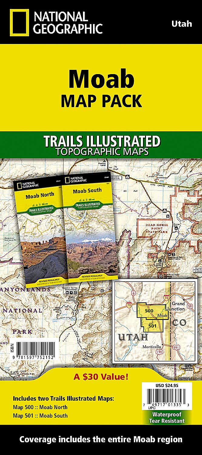
Moab [Map Pack Bundle] (National Geographic Trails Illustrated Map)
$14.95
Price: $14.95
(as of Mar 23,2022 02:26:25 UTC – Details)

From the Publisher
Plan and Guide your Epic Moab Adventures

The Most Authoritative and Beautiful Moab Trail Maps
The Moab Map Pack Bundle includes the Moab North and Moab South Trails Illustrated maps. Expertly researched and created in partnership with local land management agencies, National Geographic’s Trails Illustrated maps of Moab provide an unparalleled guide for exploring this iconic landscape. Whether your preferred mode of transportation through this wilderness is a mountain bike, whitewater raft, ATV, 4×4, or your own two feet, you’ll appreciate the unmatched detail and useful information offered on these maps.

Red Rock Playground
Sandwiched between Arches and Canyonlands National Parks, Moab is the ultimate red rock playground.
Moab North includes an inset of Monitor & Merrimac Buttes / Sovereign Trail and Moab / Slickrock areas, and additional detail for Monitor & Merrimac Buttes / Bartlett Wash / Sovereign Trail; Moab / Slickrock / Porcupine Rim; and Green River and Tenmile Point. Other areas of interest include Arches National Park, Professor Valley, Fisher Towers, and Dewey Bridge.
Moab South includes Canyonlands National Park, Dead Horse Point State Park, and Canyon Rims and Sand Flats recreation areas, as well as detail of the Moab / Poison Spider Mesa / Gemini Bridges / Hurrah Pass area.
Technical Specs
Map Scale = 1:70,000 & 1:35,000 (for inset maps)
Sheet Size = 37.75″ x 25.5″
Folded Size = 4.25″ x 9.25″
Waterproof, tear-resistant paper
Full UTM grid to aid GPS navigation
Get the Intel You Need to Explore Moab Efficiently, Enjoyably, and Sustainably


20 Years of Trail-Tested Maps
With more than 250 titles available for America’s favorite outdoor destinations, Trails Illustrated maps are the most trusted and popular recreation maps available. Continually setting the standard for accuracy, each map is crafted in conjunction with local land managers and undergoes rigorous review and enhancement before being printed on waterproof, tear-resistant material.
Save with the Bundle!
Save 15% when you buy the Map Pack Bundle. We’ve put the Moab North and Moab South Trails Illustrated maps together in this bundle product to make it easier and more affordable to for you to get the intel you need to explore the entire Moab region.
Find the Best Views and Campsites
The maps include campgrounds and public land boundaries, along with points of interest and detailed notes to keep you safe and informed. They also include rules, regulations, and guidelines for visiting and preserving the National Parks and Monuments, National Forests, Bureau of Land Management (BLM) and other public lands.
Take the Paths Less Traveled

Visit Public Lands Wisely and Sustainably
The maps include the popular parks, trails, and places of interest, but also those less-traveled and better able to absorb visitors and trail users sustainably.

Master Our Public Lands
Each map includes detailed classifications of roads, trails, and points of interest.
Publisher : Natl Geographic Society Maps; 2019th edition (January 1, 2019)
Language : English
Map : 4 pages
ISBN-10 : 1597752150
ISBN-13 : 978-1597752152
Item Weight : 6.7 ounces
Dimensions : 4.25 x 0.2 x 9.25 inches
Related Products